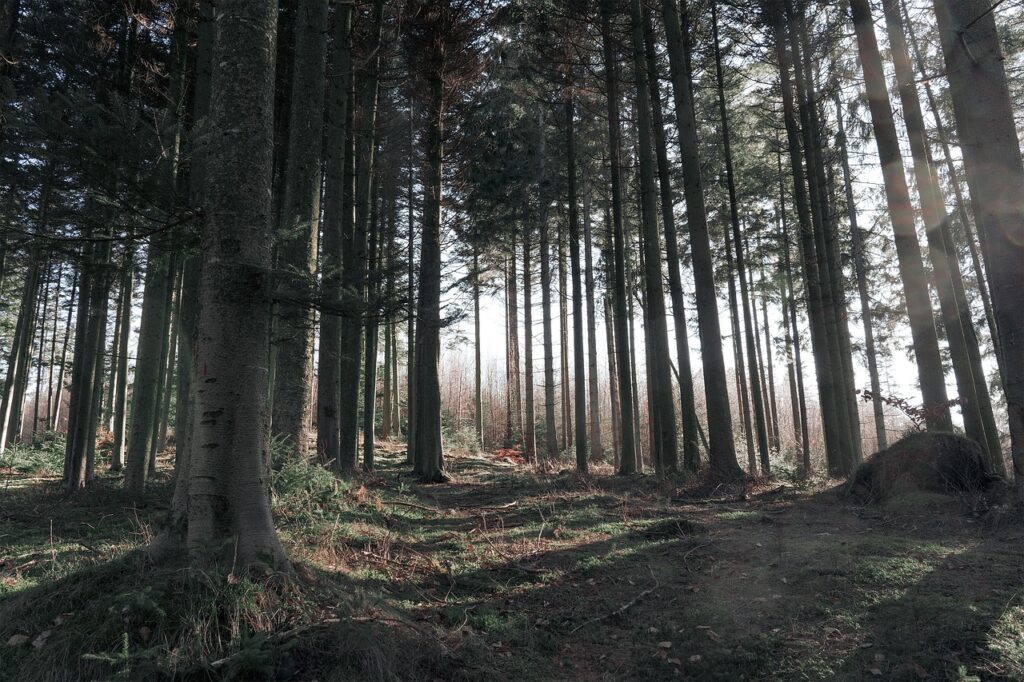
Imagine embarking on an awe-inspiring hiking adventure in the beautiful landscapes near Sacramento, CA. Nestled in the heart of California, this region offers an incredible array of hiking trails that showcase the state’s abundant natural beauty. From breathtaking mountain views to tranquil forest paths, hikers are sure to find their perfect outdoor haven. So grab your hiking boots and get ready to explore the wonders that await you on the trails near Sacramento, CA.
Best Hiking Trails near Sacramento
Hiking in California near Sacramento is an incredible experience that allows you to escape the city and immerse yourself in the natural beauty of the region. From scenic river trails to majestic mountains, there are plenty of hiking options for all skill levels. In this article, we will explore the best hiking trails near Sacramento, complete with detailed descriptions, trail difficulty ratings, trail lengths, highlights, and helpful tips. So grab your hiking boots and get ready to explore the great outdoors!
1. American River Parkway
Description
The American River Parkway is a picturesque hiking trail that follows the scenic American River for 32 miles, making it the perfect destination for nature lovers and outdoor enthusiasts. The trail winds through oak woodlands, grassy meadows, and lush riparian habitats, offering stunning views of the river and its surrounding landscapes.
Trail Difficulty
The American River Parkway trail is suitable for hikers of all skill levels, as it features mainly flat terrain and well-maintained paths. Whether you are a beginner or an experienced hiker, this trail provides a pleasant and enjoyable hiking experience.
Trail Length
The American River Parkway trail spans an impressive length of 32 miles, providing ample opportunities for exploration and adventure. You can choose to hike a short section of the trail or embark on a longer trek, depending on your preferences and time constraints.
Highlights
Some of the highlights of the American River Parkway trail include numerous access points for swimming and fishing, beautiful picnic spots, and opportunities for bird-watching. Keep an eye out for the diverse wildlife that calls this area home, including deer, beavers, turtles, and a variety of bird species.
Tips
- Bring plenty of water and snacks, especially during the warmer months.
- Wear sturdy hiking shoes or boots to ensure a comfortable and safe hike.
- Don’t forget to bring a camera to capture the scenic beauty along the trail.
- Consider hiking during weekdays or early mornings to avoid crowds.

2. Mount Diablo State Park
Description
Mount Diablo State Park offers an exceptional hiking experience with its diverse landscapes and breathtaking views. This iconic peak, located just outside of Sacramento, towers over the surrounding region and provides hikers with stunning panoramic vistas of the Sacramento Valley, the San Francisco Bay Area, and even the Sierra Nevada.
Trail Difficulty
The trails in Mount Diablo State Park vary in difficulty, catering to both beginner and advanced hikers. You can choose from easy, family-friendly trails to more challenging routes that involve steep climbs and rugged terrain. No matter your skill level, there is a trail for everyone to enjoy.
Trail Length
The trail lengths in Mount Diablo State Park range from short walks to longer hikes. You can take a leisurely stroll along the lower trails or challenge yourself with a longer trek to the summit. Be sure to plan your hike accordingly to match your fitness level and time availability.
Highlights
One of the main highlights of Mount Diablo State Park is its summit, which offers breathtaking panoramic views that stretch for miles. On a clear day, you can see the Golden Gate Bridge, the Sierra Nevada Mountains, and even the Farallon Islands. The park also features unique rock formations, vibrant wildflowers, and the opportunity to spot a variety of wildlife along the way.
Tips
- Check the weather conditions before heading out, as Mount Diablo can get extremely hot during the summer months.
- Carry plenty of water, as there are limited water sources throughout the park.
- Wear layered clothing to accommodate for temperature changes and potential wind gusts at the summit.
- Consider visiting during weekdays to avoid crowds and ensure a more peaceful hiking experience.
3. Hidden Falls Regional Park
Description
Hidden Falls Regional Park is a hidden gem located just a short drive from Sacramento. This beautiful park offers a variety of hiking trails that wind through oak woodlands, meadows, and along the scenic Coon Creek. The tranquil setting and stunning waterfalls make this park a must-visit destination for nature lovers and outdoor enthusiasts.
Trail Difficulty
The trails in Hidden Falls Regional Park are suitable for hikers of all skill levels. Whether you are looking for a leisurely stroll or a more challenging hike, you will find a trail that matches your preferences. The park offers both paved and unpaved trails, providing options for all types of hikers.
Trail Length
The trail lengths in Hidden Falls Regional Park vary to accommodate hikers with different time constraints and fitness levels. You can choose a shorter, easier trail for a quick nature walk or opt for a longer trek to explore the park more thoroughly.
Highlights
The main highlight of Hidden Falls Regional Park is, of course, the hidden waterfalls that give the park its name. As you hike through the park, you will come across several stunning cascades and sparkling pools, creating a picturesque and peaceful atmosphere. The park also offers opportunities for bird-watching, picnicking, and even horseback riding.
Tips
- Wear comfortable hiking shoes or boots, as some of the trails can be rocky or uneven.
- Bring a camera to capture the beauty of the waterfalls and the surrounding scenery.
- Pack a picnic lunch and enjoy a leisurely meal in one of the designated picnic areas.
- Consider visiting during weekdays or early mornings to avoid crowds and enjoy a more serene atmosphere.

4. Auburn State Recreation Area
Description
Located just outside of Sacramento, the Auburn State Recreation Area is a hiker’s paradise with its diverse landscapes and extensive trail system. The park encompasses over 40 miles of trails that wind through rugged canyons, along the scenic American River, and to breathtaking viewpoints.
Trail Difficulty
The trails in Auburn State Recreation Area cater to all skill levels, from easy hikes suitable for families to more challenging routes for experienced hikers. You can choose from flat, leisurely walks along the river or embark on a steep climb to enjoy panoramic vistas of the surrounding landscape.
Trail Length
With over 40 miles of trails to explore, the Auburn State Recreation Area offers hiking options for all distances and time frames. Whether you are looking for a quick nature walk or a full-day adventure, you can find a trail that suits your needs.
Highlights
One of the main highlights of the Auburn State Recreation Area is the stunning views of the American River Canyon. As you hike along the trails, you will come across picturesque viewpoints that offer sweeping vistas of the river and its surrounding canyons. The park also features hidden swimming holes, historic sites, and opportunities for picnicking and fishing.
Tips
- Carry plenty of water, as there are limited water sources along the trails.
- Wear sunscreen and a hat to protect yourself from the sun, as many of the trails are exposed.
- Keep an eye out for wildlife, including deer, eagles, and river otters, that call the park home.
- Consider purchasing a park map or downloading a hiking app to navigate the extensive trail system.
5. Eldorado National Forest
Description
Eldorado National Forest, located just a short drive from Sacramento, offers a vast wilderness for hikers to explore. This expansive forest features towering mountains, tranquil lakes, and cascading waterfalls, providing an unforgettable hiking experience.
Trail Difficulty
The trails in Eldorado National Forest range in difficulty, catering to both novice and experienced hikers. You can choose from easy, family-friendly trails that meander through meadows or challenge yourself with steep climbs to the mountain peaks. The forest offers options for all skill levels and preferences.
Trail Length
With its vast expanse, Eldorado National Forest offers hiking opportunities for all lengths and timeframes. From short nature walks to multi-day backpacking trips, you can find a trail that matches your desired distance and exploration level.
Highlights
One of the main highlights of Eldorado National Forest is its majestic mountain peaks, including the iconic Desolation Wilderness. As you hike through the forest, you will be surrounded by towering trees, serene alpine lakes, and breathtaking views of the Sierra Nevada mountain range. The forest is also home to a wide variety of wildlife, including black bears, mountain lions, and countless bird species.
Tips
- Check with the forest service for any trail closures or permit requirements before heading out.
- Carry a map and compass, as some of the trails can be remote and less well-marked.
- Pack extra layers of clothing, as the weather in the mountains can change rapidly.
- Practice Leave No Trace principles to preserve the beauty and integrity of the forest.

6. Empire Mine State Historic Park
Description
Empire Mine State Historic Park offers a unique hiking experience that combines history with natural beauty. This former gold mine, located in Grass Valley near Sacramento, features well-preserved mine buildings, manicured gardens, and scenic trails that wind through the surrounding landscape.
Trail Difficulty
The trails in Empire Mine State Historic Park are easy and accessible, making them suitable for hikers of all abilities. You can explore the park at your own pace, enjoying leisurely walks or more brisk hikes, while learning about the region’s rich history.
Trail Length
The trail lengths in Empire Mine State Historic Park vary, allowing you to customize your hiking experience based on your preferences. You can choose to take a short stroll around the mine buildings or embark on a longer hike that explores the wider park grounds.
Highlights
The main highlight of Empire Mine State Historic Park is the opportunity to explore the historic mining buildings and learn about California’s gold rush history. The park also offers beautiful gardens to wander through, picnic areas for a leisurely lunch, and serene walking paths that provide scenic views of the surrounding landscape.
Tips
- Wear comfortable walking shoes or sneakers, as the trails are easy but can be uneven in some areas.
- Take advantage of the guided tours offered by the park to learn about the history and significance of the mine.
- Bring a picnic lunch and enjoy a meal in one of the designated picnic areas.
- Visit the park during the spring or summer months to see the gardens in full bloom.
7. Lake Clementine Trail
Description
The Lake Clementine Trail is a picturesque hiking trail that leads to the stunning Lake Clementine in Auburn, just a short drive from Sacramento. This moderately challenging trail offers beautiful views of the lake, cascading waterfalls, and lush scenery, making it an excellent choice for nature lovers.
Trail Difficulty
The Lake Clementine Trail is rated as moderately difficult, featuring some uphill sections and uneven terrain. It is suitable for hikers with a moderate level of fitness and experience. While the trail is challenging at times, it rewards hikers with breathtaking views and a serene natural setting.
Trail Length
The Lake Clementine Trail is approximately 4.6 miles in length, creating a satisfying half-day hike. The trail takes you along the shores of Lake Clementine, offering plenty of opportunities to enjoy the scenic beauty and take in the tranquility of the area.
Highlights
One of the main highlights of the Lake Clementine Trail is the towering North Fork Dam, which creates Lake Clementine. As you hike along the trail, you can also admire the majestic American River Canyon and enjoy the breathtaking views of the cascading waterfalls in the area. The trail offers a unique blend of natural beauty and engineering marvels.
Tips
- Start early in the day to avoid crowds and secure parking in the designated areas.
- Bring plenty of water and snacks, as there are limited amenities along the trail.
- Wear sturdy hiking boots for better traction on the occasionally rocky and uneven terrain.
- Consider bringing a swimsuit and towel if you want to take a refreshing dip in the lake.
8. Point Reyes National Seashore
Description
Point Reyes National Seashore, located just a short drive from Sacramento, offers a unique coastal hiking experience like no other. This stunning park features rugged cliffs, sandy beaches, and an abundance of wildlife, creating a diverse and captivating environment for hikers to explore.
Trail Difficulty
The trails in Point Reyes National Seashore vary in difficulty, catering to all skill levels. You can choose from easy coastal walks to more challenging hikes that involve steep climbs and uneven terrain. The varied landscapes and breathtaking views make every trail in the park worth exploring.
Trail Length
The trail lengths in Point Reyes National Seashore range from short, leisurely walks to longer, more adventurous hikes. You can opt for a quick stroll to admire the coastal scenery or set out on a longer trek to explore the park’s hidden gems.
Highlights
One of the main highlights of Point Reyes National Seashore is its abundant wildlife. The park is home to a variety of species, including tule elk, harbor seals, elephant seals, and countless bird species. Additionally, the park boasts stunning coastal views, picturesque lighthouses, and secluded beaches that offer a peaceful and serene atmosphere.
Tips
- Check the park’s website for any trail closures or restrictions before starting your hike.
- Carry extra layers of clothing, as the coastal weather can be unpredictable and chilly.
- Bring binoculars to get a closer look at the wildlife and marine creatures.
- Stay on designated trails to protect the fragile coastal ecosystem.
10. Daffodil Hill
Description
Daffodil Hill, located in the charming town of Volcano near Sacramento, is a must-visit destination for flower enthusiasts and nature lovers. This enchanting hill is covered with vibrant daffodils, creating a breathtaking display during the spring season.
Trail Difficulty
The trails around Daffodil Hill are easy and accessible to all visitors. There are multiple paths that allow you to explore the hill and admire the daffodils up close, making it suitable for hikers of all abilities.
Trail Length
The trails around Daffodil Hill are relatively short, allowing you to explore the hill and its surrounding gardens at a leisurely pace. You can spend as much time as you like immersing yourself in the beauty of the daffodils and enjoying the peaceful atmosphere.
Highlights
The main highlight of Daffodil Hill is, of course, the stunning display of daffodils that cover the hill during the spring season. This picturesque sight attracts visitors from far and wide, providing a unique and memorable experience. The hill also features charming gardens, picnic areas, and a gift shop where you can purchase bulbs to take home.
Tips
- Visit Daffodil Hill during the spring season, when the daffodils are in full bloom, usually from late March to early April.
- Arrive early in the day to avoid crowds and secure parking in the designated areas.
- Take your time to explore the gardens and appreciate the beauty of the daffodils.
- Be respectful of the surroundings and avoid trampling the flowers.
In conclusion, Sacramento and its surrounding areas offer a wealth of hiking trails that cater to different skill levels and preferences. Whether you prefer scenic river trails, mountainous landscapes, or coastal vistas, there is a trail waiting for you to explore. So grab your hiking gear, pack some snacks and water, and embark on an adventure to discover the natural beauty that awaits near Sacramento. Happy hiking!

